
When you are about to take a trip, especially with unfamiliar long routes, locating gas stations along the route will play a very important role. Thanks to Google Maps, locating gas stations on a road becomes extremely simple and accurate.
This is also a great trick that you can take advantage of while driving, as it works directly during navigation without you having to do anything extra. Simply add a stop to your existing route, fill up at the gas station, then resume your trip in no time.
Locate gas stations on route with Google Maps
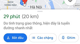
To get started, open Google Maps on your iPhone, iPad, or Android device, locate your destination, and start navigating by tapping the arrow icon button.
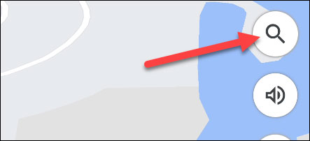
Now tap the icon magnifying glass on the right side of the map to do a search.
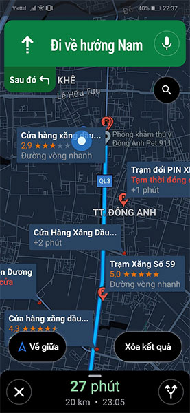
You can click on the “The gas station”, or search for the name of a specific gas station that you think might be on the route. Note that this interface will look slightly different on the iPhone, but it will still mean the same thing.

A list of gas stations will be displayed on the top of the route. Scroll around and choose one of the gas stations that is most convenient to your direction of travel.
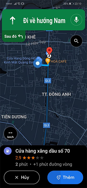
Next, information about the gas station will show up at the bottom of the screen. You can choose “Cancel” or “More” Stop point. Gas stations are automatically added to the route after a few seconds; This is a hands-free feature.
Google Maps will now take you to the right gas station. You can then continue your route as usual.
Wish you safe driving!
Source link: How to find gas station location on route with Google Maps
– https://techtipsnreview.com/